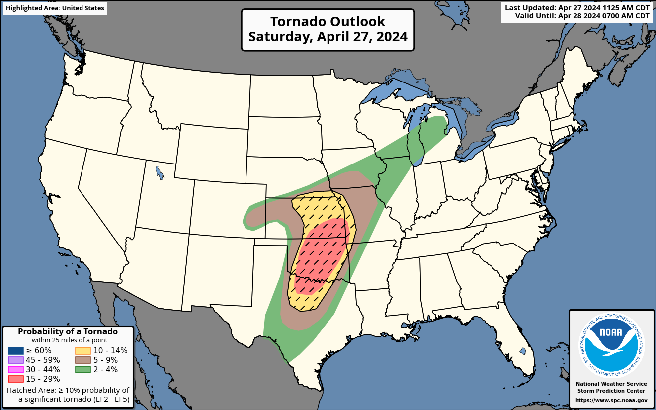
About This Product
The Day 1 Tornado Outlook is issued as part of the Day 1 Severe Weather Outlook, issued by the National Weather Service's Storm Prediction Center every several hours. This map displays the expected probability of a tornado within 25 miles of a point.
Hatched areas indicate the maximum potential intensity of tornadoes, should they occur:
- Dashed-line hatching indicates some potential for significant (EF2 or greater) tornadoes.
- Solid hatching indicates a dangerous environment capable of producing intense (EF3 or greater) tornadoes.
- Cross-hatching indicates an extremely dangerous environment with potential for violent (EF4 or greater) tornadoes.
These probabilities contribute to the categorical Day 1 Severe Weather Outlook in accordance with the Probabilistic to Categorical Outlook Conversion Table.