About This Product
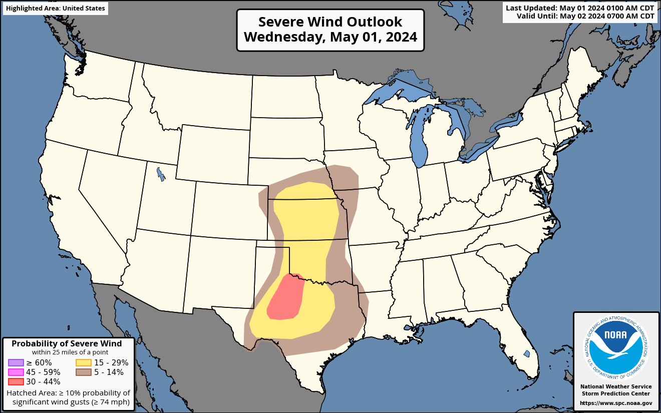
The Day 1 Severe Wind Outlook is issued as part of the Day 1 Severe Weather Outlook, issued by the National Weather Service's Storm Prediction Center every several hours. This map displays the expected probability of severe wind (at least 58 mph) within 25 miles of a point.
Hatched areas indicate the maximum potential intensity of severe thunderstorm wind gusts, should they occur:
- Dashed-line hatching indicates some potential for significant thunderstorm wind gusts (at least 75 mph).
- Solid hatching indicates a dangerous environment capable of producing very significant thunderstorm wind gusts (at least 85 mph).
- Cross-hatching indicates an extremely dangerous environment with potential for extremely damaging wind gusts (at least 95 mph).
These probabilities contribute to the categorical Day 1 Severe Weather Outlook in accordance with the Probabilistic to Categorical Outlook Conversion Table.